When riding Minor Roads that have varied surface from Concrete, what was concrete but in bad state, Tarmac, Dirt , Gravel, Rocky, how do you Contributors make NOTE of what surface it is and where it starts and stops?
In a Car, with a Navigator to take Notes and Press Track Point on the Surface Change, it would not be a problem.
But when I am riding such roads, it is usually Solo with friends on our Dual Sport Bikes.
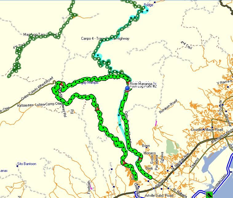
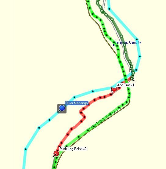
Brett (govoner) has a GoPro 960 Helmet-cam. I recently got a copy of his 'raw' Video of a ride up the 'Bamboo Trail', Magahuway, Cebu, as well as a copy of his Garmin GPSMAP 60CSX Track Log.
I am hoping if I can synchronise these. Pick a distinctive Point on the track to be both the Start of the GPS Track on MapSource and Cut the Video to Start at that very same spot, So with both synchronised, it should be able to pause the Video at the change of Track Surface and determine via elepsed time where that is on the Track in Mapsource.
Probably easier to buy the ContourGPS Camera, that has a built in GPS and automatically adds a Synch Track.
.jpg)

As I dont have any Helmet-cam, that is the one I would probably buy.
Brett (govoner) could pay out for the DashWare application.
See "Adding GPS Track Map to Helmet-cam Videos"
 http://dashware.net/
This is software that makes the job of synching ones Video, to the GPS Track Log, a lot easier. Plus one can add animated Icons for Speedometer, Altimeter and Oddometer as well as a Clock. You can also add a GPS Track Map with a moving Icon showing where the Video was being recorded, as you watch the edited final version, with all these 'overlays' added.
However ContourGPS has one big advantage over DashWare and your GoPro Camera and Garmin GPS. That is the Android or iOS App that adds Wirless Monitor /Remote Control!

Now this really got me thinking - what if you could add a motorized Pan/Tilt mount, controlled by such screen App (or a button that simply swings it from straight ahead, through 90 degrees anticlockwise). Press for a left side shot sequence, and press it again, for a rearwards shot sequence. Press again and your shooting to the right, and once more for straight ahead again.
OK the video, as its panning, is not likely to be good quality (but those bits can be edited out in final version).
Since I can't afford to buy a ContourGPS right now that will have to be an idea on the 'back burner' for a while.
A more affordable solution might be a 'SPY' Audio Logger. These are small, like a Pen, so easy to mount such, that your Voice inside the crash helmet is recorded. Usually Voice Activated and provide a Digital Date/Time Stamp.
So provided you set the Time on the Spy 'Pen' Audio Recorder to be GMT (which is what GPS Satellites are set to) it should be in Synch with your Garmin GPS Track Log. Then when you hear 'Concrete' recorded, you should be able to find that time on the GPS Track Log and add a Waypoint that you can lable 'Concrete'. Then when you hear 'Dirt', you can add another Waypoint parking the end of 'Concrete' and back to 'Dirt'.
I could achieve the same with my Nokia N95 8GB Phone if I took a Photo at each and every change of surface. The Photo would be GEO-tagged and hopefully shows what the surface is. The problem is how to mount such and operate it while wearing gloves. If/when I take my asawa as back rider she could tackle that.
In a Car, with a Navigator to take Notes and Press Track Point on the Surface Change, it would not be a problem.
But when I am riding such roads, it is usually Solo with friends on our Dual Sport Bikes.
Brett (govoner) has a GoPro 960 Helmet-cam. I recently got a copy of his 'raw' Video of a ride up the 'Bamboo Trail', Magahuway, Cebu, as well as a copy of his Garmin GPSMAP 60CSX Track Log.
I am hoping if I can synchronise these. Pick a distinctive Point on the track to be both the Start of the GPS Track on MapSource and Cut the Video to Start at that very same spot, So with both synchronised, it should be able to pause the Video at the change of Track Surface and determine via elepsed time where that is on the Track in Mapsource.
Probably easier to buy the ContourGPS Camera, that has a built in GPS and automatically adds a Synch Track.
Video mapping from the world's smallest and lightest gps video camera.
The ContourGPS captures beautiful 1080p video.
It utilizes a 135° wide-angle rotating lens that delivers a true high quality image that captures all the action with minimal distortion and fish-eye.
It records Full HD in all its glory.
Compare Cameras
The ContourGPS captures beautiful 1080p video.
It utilizes a 135° wide-angle rotating lens that delivers a true high quality image that captures all the action with minimal distortion and fish-eye.
It records Full HD in all its glory.
Compare Cameras
Add GPS to the Story
Whether retracing your laps at the ski hill, checking your speed on a DH run or logging the gain on a road ride, the tracking capability of the ContourGPS adds speed, location and elevation to the picture. The ContourGPS is set up with a GPS receiver that auto-maps the three essentials - location, speed and elevation - at up to two times per second to create a continuous track of coordinates. After the fact, the GPS track synchronizes with your footage to provide a second-by-second replay via Google Maps of the run you ripped, the route you rallied or the ride you crushed.
Whether retracing your laps at the ski hill, checking your speed on a DH run or logging the gain on a road ride, the tracking capability of the ContourGPS adds speed, location and elevation to the picture. The ContourGPS is set up with a GPS receiver that auto-maps the three essentials - location, speed and elevation - at up to two times per second to create a continuous track of coordinates. After the fact, the GPS track synchronizes with your footage to provide a second-by-second replay via Google Maps of the run you ripped, the route you rallied or the ride you crushed.
As I dont have any Helmet-cam, that is the one I would probably buy.
Brett (govoner) could pay out for the DashWare application.
See "Adding GPS Track Map to Helmet-cam Videos"
This is software that makes the job of synching ones Video, to the GPS Track Log, a lot easier. Plus one can add animated Icons for Speedometer, Altimeter and Oddometer as well as a Clock. You can also add a GPS Track Map with a moving Icon showing where the Video was being recorded, as you watch the edited final version, with all these 'overlays' added.
However ContourGPS has one big advantage over DashWare and your GoPro Camera and Garmin GPS. That is the Android or iOS App that adds Wirless Monitor /Remote Control!
Mobile Connection
With the new Bluetooth® capability of the ContourGPS we've made it possible to check your angle on a smartphone screen before dropping in or taking off. The Contour App creates a wireless handheld viewfinder that enables you to align your shot to make sure you have the right angle and eliminate guesswork. Made for both iOS and Android, the ContourGPS connection also allows users to tweak settings via phone on the hill or at home.
Learn more
Now this really got me thinking - what if you could add a motorized Pan/Tilt mount, controlled by such screen App (or a button that simply swings it from straight ahead, through 90 degrees anticlockwise). Press for a left side shot sequence, and press it again, for a rearwards shot sequence. Press again and your shooting to the right, and once more for straight ahead again.
OK the video, as its panning, is not likely to be good quality (but those bits can be edited out in final version).
Since I can't afford to buy a ContourGPS right now that will have to be an idea on the 'back burner' for a while.
A more affordable solution might be a 'SPY' Audio Logger. These are small, like a Pen, so easy to mount such, that your Voice inside the crash helmet is recorded. Usually Voice Activated and provide a Digital Date/Time Stamp.
So provided you set the Time on the Spy 'Pen' Audio Recorder to be GMT (which is what GPS Satellites are set to) it should be in Synch with your Garmin GPS Track Log. Then when you hear 'Concrete' recorded, you should be able to find that time on the GPS Track Log and add a Waypoint that you can lable 'Concrete'. Then when you hear 'Dirt', you can add another Waypoint parking the end of 'Concrete' and back to 'Dirt'.
I could achieve the same with my Nokia N95 8GB Phone if I took a Photo at each and every change of surface. The Photo would be GEO-tagged and hopefully shows what the surface is. The problem is how to mount such and operate it while wearing gloves. If/when I take my asawa as back rider she could tackle that.
Comment